As on the Moon, future human settlements on Mars will have to be located near an essential resource:water. But you still have to know where it is.
If SpaceX's Mars projects are often mentioned, let's remember that NASA also plans to launch a manned mission to the Red Planet in the 2030s, with the ambition of establishment of a first research outpost. With this in mind, future explorers should rely on local resources whenever possible.
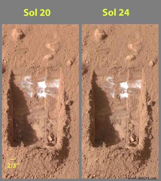
Probably the most important of these resources is water ice which will not only be crucial for survival supplies, but will be used for agriculture or even for the production of rocket fuel by splitting it into its constituents hydrogen and oxygen. In other words, water ice will be essential to be able to live on site, but also to return to Earth.
Finally, water ice could be studied for purely scientific purposes with the aim, for example, of probing the possible presence of traces of microbial life.
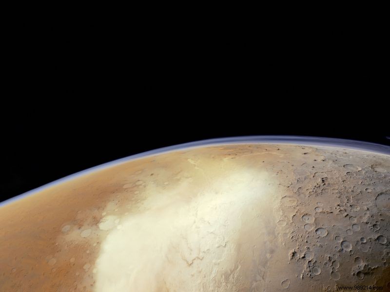
According to NASA, this base will probably have to be built at Martian mid-latitudes . There is ice, but also enough heat and sunlight to operate. The Martian poles are indeed also home to a lot of ice, but they also have the disadvantages of being very cold and very dark.
Mid-latitude terrain also tends to be low-lying, which is a real plus for landing. Mars is indeed coated with a very thin atmosphere, too thin to allow heavy machines to brake enough to allow a smooth touchdown. Also, the more atmospheric thickness there is, the less complicated it will be to land.
If we know that there is ice at the mid-latitudes of the planet, the question we must now ask is:where is the ice hiding? precisely? A new project called Subsurface Water Ice Mapping (SWIM), led by the Planetary Science Institute in Tucson, Arizona, allows us today to see a little more clearly.

To draw this map, the researchers relied on data collected over the past two decades by three NASA orbiters (Mars Reconnaissance Orbiter, Mars Odyssey and Mars Global Surveyor) using five different remote sensing techniques, including neutron spectroscopy and radar.
"Ultimately, NASA commissioned Project SWIM to figure out how far from the equator you could go to find ice underground “Summarizes Sydney Do, head of the Mars Water Mapping Project at JPL. “Imagine that we drew a wavy line across Mars representing this ice boundary. This data allows us to draw this line with a thinner pen instead of a thick marker and focus on the parts of this line closest to the equator “.
The SWIM team has just published its first results this Monday in the journal Nature Astronomy. And these data are encouraging. It appears that large strips of land that cover the mid-latitudes are home to ice buried at depths ranging from only a few centimeters to a kilometer.

Of course, delivering humans safely to Mars and ensuring their survival requires many other considerations beyond the in situ use of water resources. Also, the choice of the future landing site is obviously not yet relevant. Nevertheless, these data may be reviewed and taken into consideration by decision-makers in due course.
They could also be further refined in the years to come. NASA has indeed partnered with three space agencies (Italy, Canada, Japan) to work on a mission project called Mars Exploration Ice Mapper. The objective will be to map exploitable ice deposits by the crews of a manned mission. This mission could be launched as early as 2026 .